

Suzanne Lazaroo
6 November 2019: Launched at the University of Canberra today, the Australian Geospatial Health Lab will map the way forward for a healthier population, drawing on a combination of geospatially-expressed environmental and health data to improve overall population health and wellness.
The Lab’s ground-breaking approach will provide insight into and analysis of population health patterns, supporting healthier lifestyles and helping to prevent chronic illness – which will ultimately reduce demand on hospitals and the health system in the future.
It’s a game-changing approach with the potential to positively shift the collective health trajectory of the community, even the country.
The Lab is the result of a partnership between the University and Esri Australia, the global leader in the Geographic Information System (GIS) technology underpinning its work.
The GIS infrastructure ingests and analyses many different themes of data, organising the data together in a visual manner to form multi-layered 3D visualisations, informed by spatial statistics.
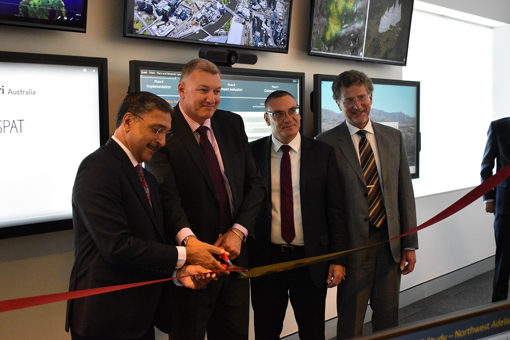
From left: University of Canberra Vice-Chancellor and President Professor Deep Saini, Michael De’Ath, Director-General of the ACT Health Directorate, Brett Bundock, Group Managing Director for Esri Australia and Esri South Asia, and Professor of Epidemiology Mark Daniel from the University of Canberra’s Health Research Institute, at the launch of the Australian Geospatial Health Lab. Photo: Madeleine Wood
Brett Bundock, Group Managing Director for Esri Australia and Esri South Asia, said GIS technology is driving broad innovation across the health sector globally, facilitating a new definition of connected care.
“The technology used to draw pivotal insights for the Australian Geospatial Health Lab also underpins the delivery of connected care. Everything from record management for in-patients through to their repatriation back into the community – it sorts the science to show you the information that matters,” Mr Bundock said.
“This is the same technology driving insights for almost every government department and council in Australia, which means these groups could effectively plug into the system, creating an interconnected community and delivering a complete picture of Australia’s health landscape.”
These visualisations and spatial analyses reveal insights into patterns and relationships among the different layers of information, for which the UC-Esri Australia team then conducts sophisticated statistical analyses of spatial data to enable rigorous evidence-based inference for health policy, including policy evaluation.
This allows the Lab to get a more accurate picture when comparing health indicators – and relationships between health indicators and environmental influences – among suburbs, regions and states in the country, and even beyond national borders.
Because the Lab’s data security meets defence industry standards, even organisations that work with highly sensitive population data can collaborate with the research team, to explore how environmental determinants like geographic location and the built, physical and social, environment might influence health, and look for ways to prevent risk and reduce the consequences of disease.
According to Professor of Epidemiology Mark Daniel from the University’s Health Research Institute (HRI), the Lab supports the determination of how spatially variable risk conditions (the environment) shape risk factors, specifically whether an individual is enabled (or not) through their specific context to live a healthy lifestyle, or one that is risky to their health.
“We can evaluate the features of their spatial environment that shape how people develop risk factors like poor diet, physical inactivity, alcohol use and smoking, in conjunction with clinical measures and biomarkers, their disease outcomes, and disease consequences, such as complications or hospitalisation,” Professor Daniel said.
He adds that ideas of health are ultimately shaped by both local social norms and one’s living environment.
“Local community norms vary geographically and spatially across locations, and if the norms in your local community are largely unhealthy your risks are going to be higher relative to other communities – even if you are living more healthily than others in your community.”
The research team can combine various datasets incorporating satellite images, public open space, vegetation, road networks, transportation grids, property values, census information, local businesses, crime and safety statistics, access to healthcare, and healthcare costs, among others.
The research team has been able to include a set of questions in the next National Health Survey to be conducted by the Australian Bureau of Statistics. This will enable them to potentially tie in data from the Medicare Benefits Scheme and Pharmaceutical Benefits Scheme to understand how people’s environment is shaping their health over time.
“We can then better assess an individual’s risk of contracting – and how to better manage – conditions like obesity, metabolic syndrome, diabetes, cardiovascular diseases and cancers, based on their location,” Professor Daniel said.
“Much of the work to-date has been on census-type data relating to ill health. We are going beyond a purely social census-based perspective to look at what is happening – or not happening – on the ground, and in the built environment, that is associated with the evolution of ill health over time.”
The team can then identify high-priority targets and decision-making tools to help deliver more targeted clinical and public health interventions, as well as support broader efforts for planning healthy environments.
The UC-Esri team is looking to influence policy in support of healthful outcomes.
“This will be through better urban design, more efficient public transportation which gets people out and moving, gets people out of their cars, and creates better access to public open spaces, healthful food source options, and accessible health and medical care,” Professor Daniel said.
“Back in the 1940s, the tobacco companies said that there was no evidence that smoking lead to cancer. We’re seeking to provide the hard, scientific evidence around the need for healthy environments, because environments shape lifestyles and health risks and outcomes.
“These factors might seem inherently obvious, but without the evidence, it’s hard to argue for them in a policy sense, and to generate support for prevention – even secondary and tertiary prevention – over a disproportionate emphasis on acute care and hospital-based intervention.”
While scientists have been searching for ways to do this kind of research for the last two decades, Professor Daniel says that the major stumbling blocks have been the lack of a basis for standardised, comparative cross-jurisdictional work, and major blocks in linking sensitive health outcomes and spatial environment datasets.
The Australian Geospatial Health Lab has overcome those limitations – and is now looking to collaborate with more partners.
“It really is a win-win situation, because we get access to health outcomes data and our partners get the benefits of outcomes analyses enriched with spatial data – this will help them to do what they do better,” Professor Daniel said.